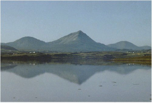
Errigal, centre, taken from Dooey strand early on a summer's day. The mountain to the left is Mackoght, part of the Glover Highlander walk route while to the right and more distant is Slieve Snaght, which is in the Glenveagh National Park. The ascent up Errigal is 346m, and it is hard to avoid the gradient of around 25 to 30%.
The last check point of the organised walk and its official end is in Dunlewy which is approximately in line with the summit of Errigal in this photo, but on the other side. From the top if you take a direct route to the end, then you will walk down a scree slope, which is long and unstable in places.
Fears of causing erosion damage have led many people to avoid this route, however whatever route is chosen it is necessary to drop around 690m to get to the road, a serious test of the knees and patience!
Return to Glover description.